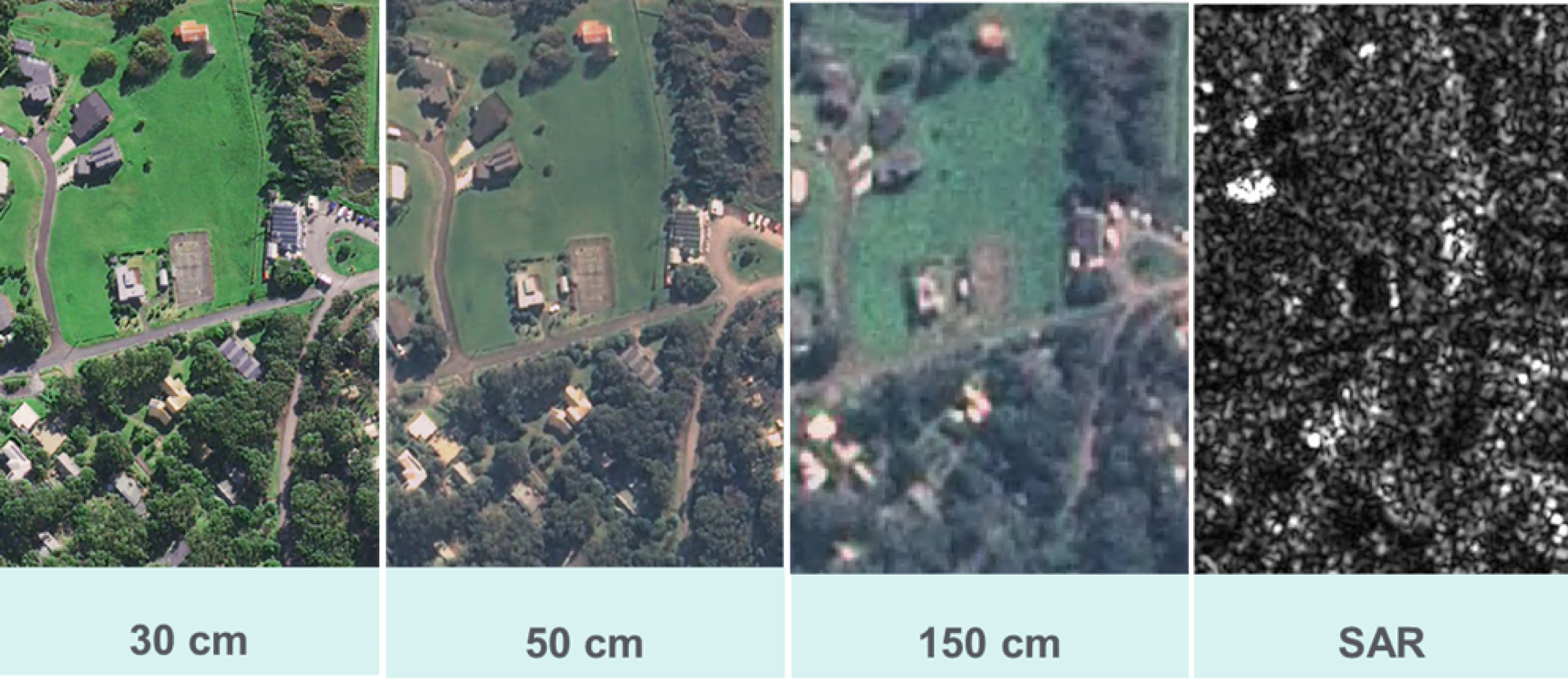
GSD resolution: 30cm
Revisit frequency: Twice per day
Bands:
- red
- green
- blue
- NIR
- deep blue
- red edge

Our on-demand Satellite Tasking Service is available to state and local government agencies. It enables quicker access to high-resolution and high-accuracy satellite imagery.
Satellite imagery offers many advantages over traditional aerial imagery including its efficiency in capturing large areas in a short amount of time. It also makes it easier to compare changes to a location over time through repeat captures.
The service also offers access to synthetic aperture radar (SAR) technology. SAR allows for the acquisition of imagery at nighttime, as well as during periods of high cloud cover.
Satellite imagery is currently used by government and emergency services for a range of uses including:
Through the Satellite Tasking Service, state and local government agencies can access 54 satellites that are in orbit.
The service offers near real-time delivery of high-quality imagery at various resolutions. Suppliers offer turnaround times between 2-12 hours post-capture.
You can also acquire archived satellite imagery at various resolutions.
The below information provides technical details of the different satellites available to task.
GSD resolution: 30cm
Revisit frequency: Twice per day
Bands:
GSD resolution: 50cm
Revisit frequency: Once per day
Bands:
GSD resolution: 30cm
Revisit frequency: Up to 12 times per day
Bands:
GSD resolution: 1.5m
Revisit frequency: Once per day
Bands:
GSD resolution: 3m
Revisit frequency: Every 4.5 to 85 hours
Bands:
Satellite imagery is only available to state and local government agencies.
To access satellite imagery, please submit an expression of Interest or email vicmap@transport.vic.gov.au
Read more about satellite imagery:
Page last updated: 22/12/25