Overview
The Vicmap Elevation 1m Digital Elevation Model (DEM) is a mosaic product that delivers the best available 1m DEM data for Victoria through spatial web services.
The spatial web services include terrain, relief, hill shade and footprints.
The data used in the 1m DEM draws from the state's archive of ground surface model datasets known as the Vicmap LiDAR DEMs Collection.
Only datasets meeting 1m resolution and +/- 10cm RMSE vertical accuracy standards are included in the Vicmap 1m DEM.
Data access
The Vicmap 1m DEM web services are currently only available under license to Government users. Private companies and members of the public can contact our Data Service Providers to access the data used in the 1m DEM web services.
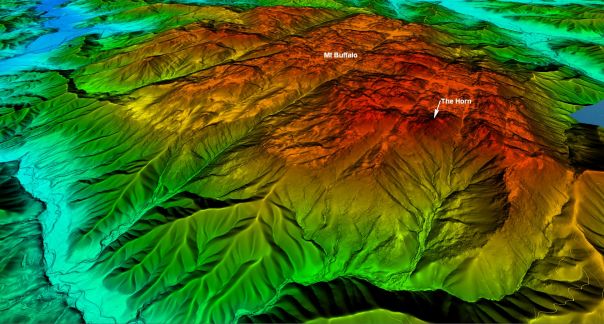
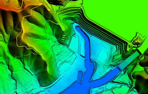
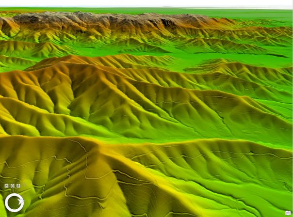
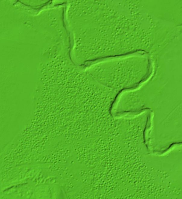
You can view free 3D samples of the Vicmap 1m DEM data using our Sample Service viewer. The map also shows the set of footprints for all DEM datasets used across the Vicmap 1M DEM web services. The footprints can help identify specific DEM datasets when requesting data from our Data Service Providers.
Government licensed use
Access to the Vicmap 1m DEM web services by Government users is subject to licensed use. A Data Access License Agreement (DALA) provides the terms and conditions of use, including license fees determined under the Vicmap Elevation subscription model.
Elevation subscriptions also include access to:
- Vicmap Elevation – LiDAR DEMs Collection
- Vicmap Elevation – LiDAR Points Collection
Government agencies can contact vicmap@transport.vic.gov.au for information on subscriptions.
Explore services
Explore the two freely available 1m DEM web services:
- The 1m DEM Footprints service describes the datasets used in the 1m DEM mosaic.
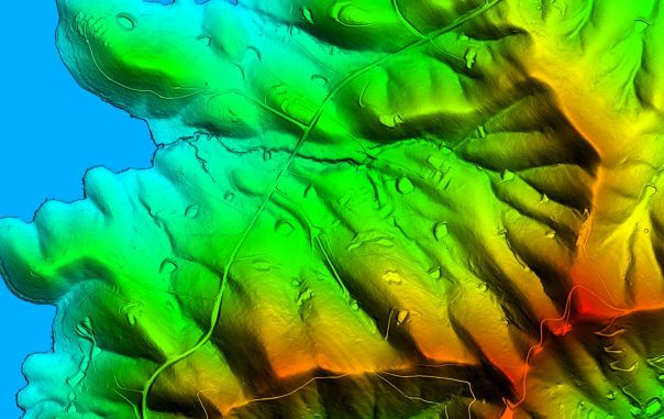
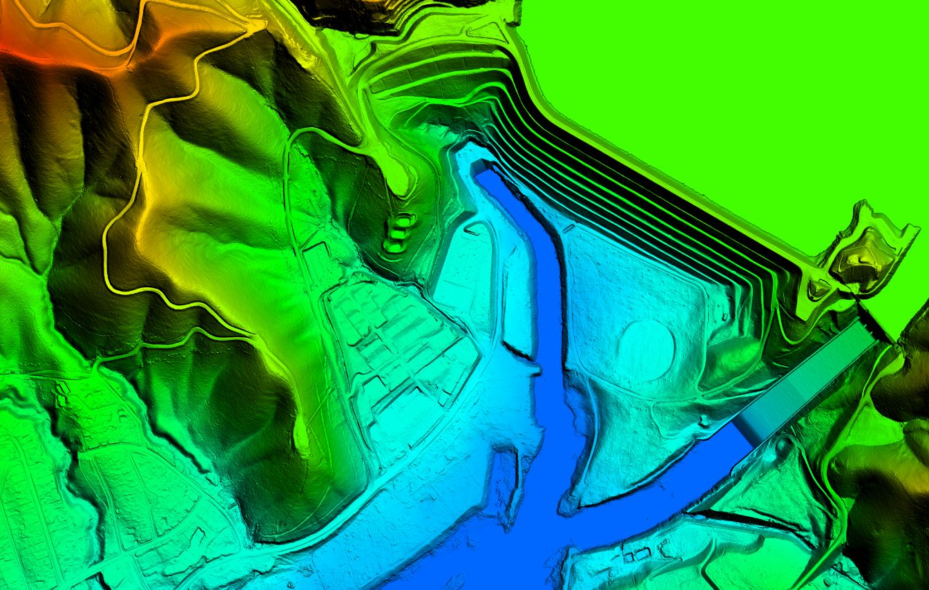
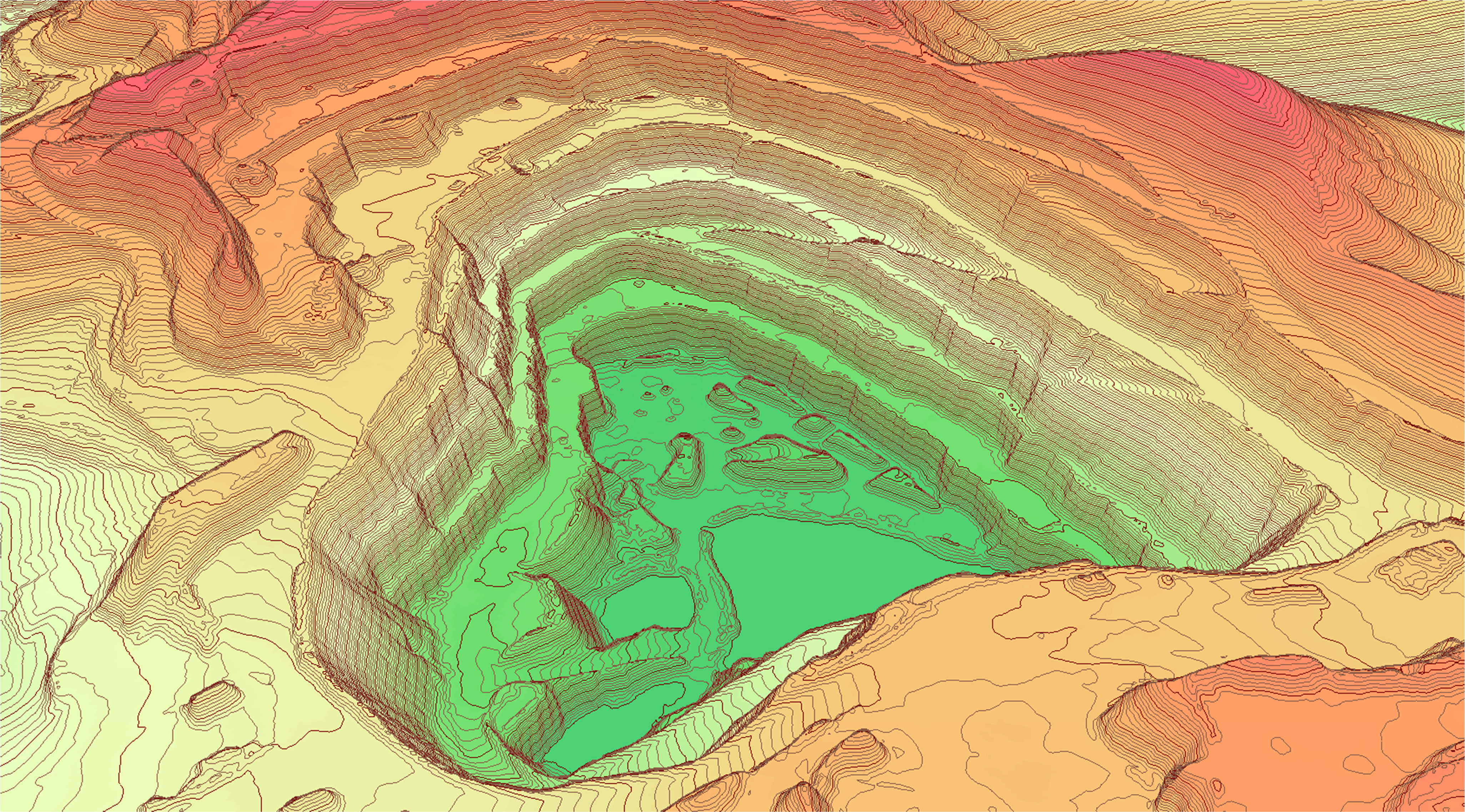
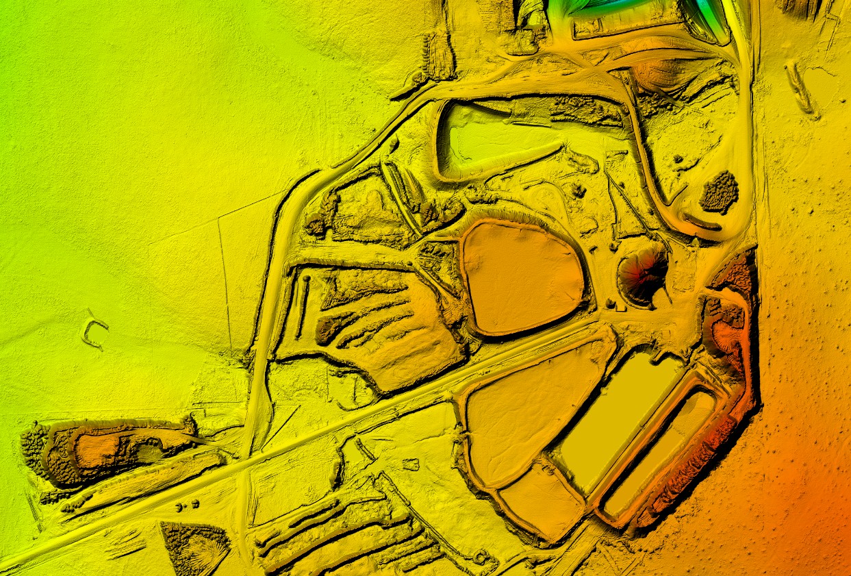
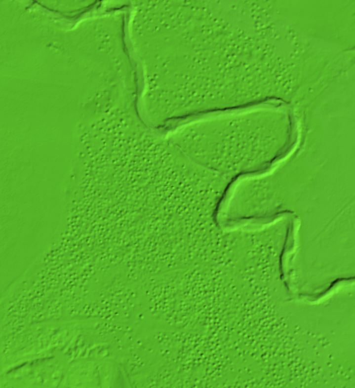
- The 1m DEM Sample Service viewer delivers sample areas of the 1m DEM data as a coloured hill shade.
The Vicmap 1m DEM Sample Service viewer provides free and open access to selected snippets of Vicmap 1m DEM data around the state. Users can access this service to gauge the detail and quality of data before committing to purchasing a license.
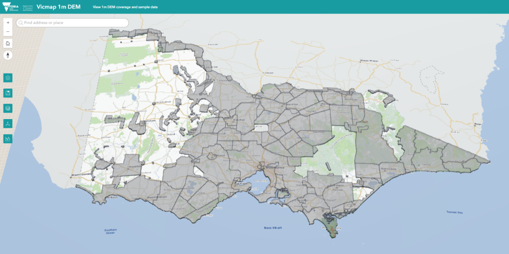
Explore 1m DEM via Sample Service viewer
Product resources
Frequently Asked Questions
Want to learn more? Here are the most common question and answers.
How to get help
Please contact vicmap@transport.vic.gov.au for any further information or questions.