
On this page:
What is LiDAR?
LiDAR (Light Detection and Ranging) is an invaluable tool for mapping and modelling physical features of the ground and the objects on it to enable the creation of 3D digital models of places. It is an increasingly common method of gathering elevation data. While there are various sources of elevation data, LiDAR is our primary source.
The technology works by illuminating a feature with a pulsed laser light. The laser reflections bounce off the feature and back to a sensor. The sensor then measures the distance between the feature and the sensor (based on the time it took the laser light to bounce back), as well as the intensity of the light that was reflected.

-

-
Intensity values can be used to help classify what kind of feature the laser encountered. For example, a sealed road has a different reflective intensity than vegetation, allowing these features to be visualised and modelled separately. The resulting measurements are represented as individual points that have attributes including their height, colour and intensity. These measurements are referred to as a “point cloud.”
Because LiDAR has its own source of light (the laser) it is classified as an “active sensor”. This is different to a “passive sensor” such as a camera that can only sense and record light that is already present. This means that LiDAR surveys can be conducted at any time of day or night, and in any season.
How is LiDAR data captured?
LiDAR sensors can be affixed to many different types of platforms. These can include aerial platforms like planes, helicopters and drones, mobile platforms like cars, and even mobile devices such as phones or handheld surveying equipment.
For large scale surveying, aerial LiDAR is most often used. This involves an aircraft flying over the landscape and continuously making measurements. The technique yields a highly detailed three-dimensional profile of ground, vegetation, and built structures.
An important aspect of aerial LiDAR surveys is their point density. Depending on the project, the survey will be conducted at different altitudes, speed and with different LiDAR scanners to optimise point density. Generally, the point cloud has a point density that can vary from 4 points per m2 to well above 50 in some cases.
What elevation data do we have?
Since 2006, through the Coordinated Imagery Program (CIP) in the Department of Transport and Planning (DTP), public sector partners have invested in over 150 LiDAR surveys of both urban and natural environments across the state.
Learn more about some of our more significant LiDAR projects below, including LiDAR mapping of the whole of greater Melbourne, the Great Ocean Road, Budj Bim cultural landscape, regional towns and Victoria’s rivers and coastline.
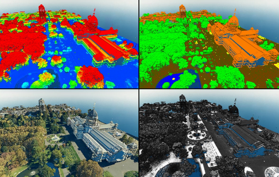
- LiDAR composite view of Mansfield, 2021-24 Digital Twin Victoria LiDAR.
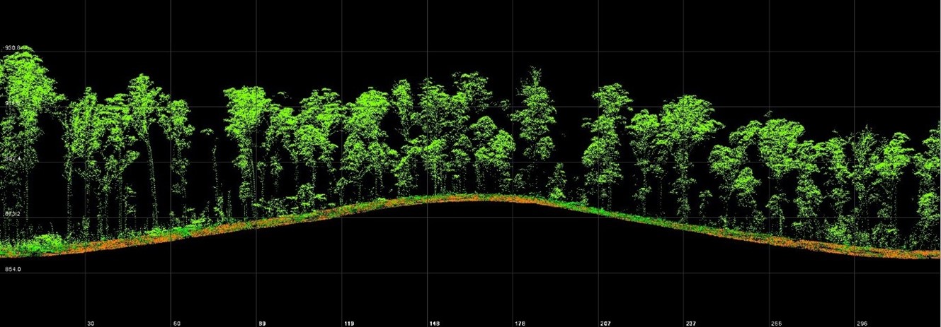
- View of elevation products using hillshade and false-colour for height above ground, 2020-21 East Gippsland and Central Highlands RFA LiDAR.
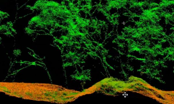
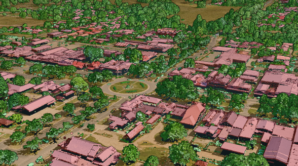
- Point cloud, 2019-2020 Budj Bim LiDAR in partnership with Gunditj Mirring Traditional Owners Aboriginal Corporation (GMTOAC).

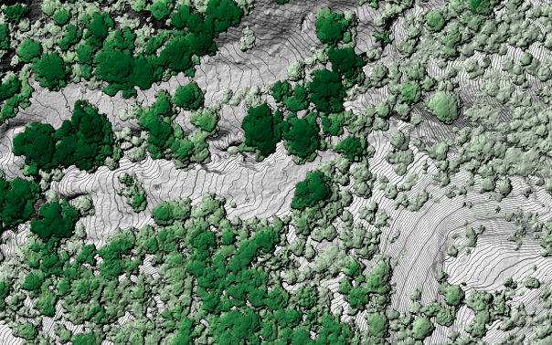
- 2019-20 Great Ocean Road LiDAR.
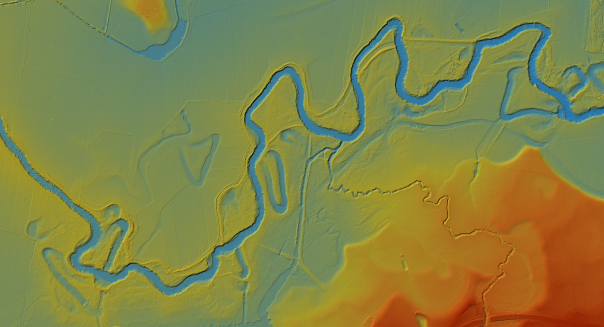
- 2009-10 Victorian rivers LiDAR.

LiDAR composite view of Mansfield, 2021-24 Digital Twin Victoria LiDAR.

View of elevation products using hillshade and false-colour for height above ground, 2020-21 East Gippsland and Central Highlands RFA LiDAR.

Point cloud, 2019-2020 Budj Bim LiDAR in partnership with Gunditj Mirring Traditional Owners Aboriginal Corporation (GMTOAC).
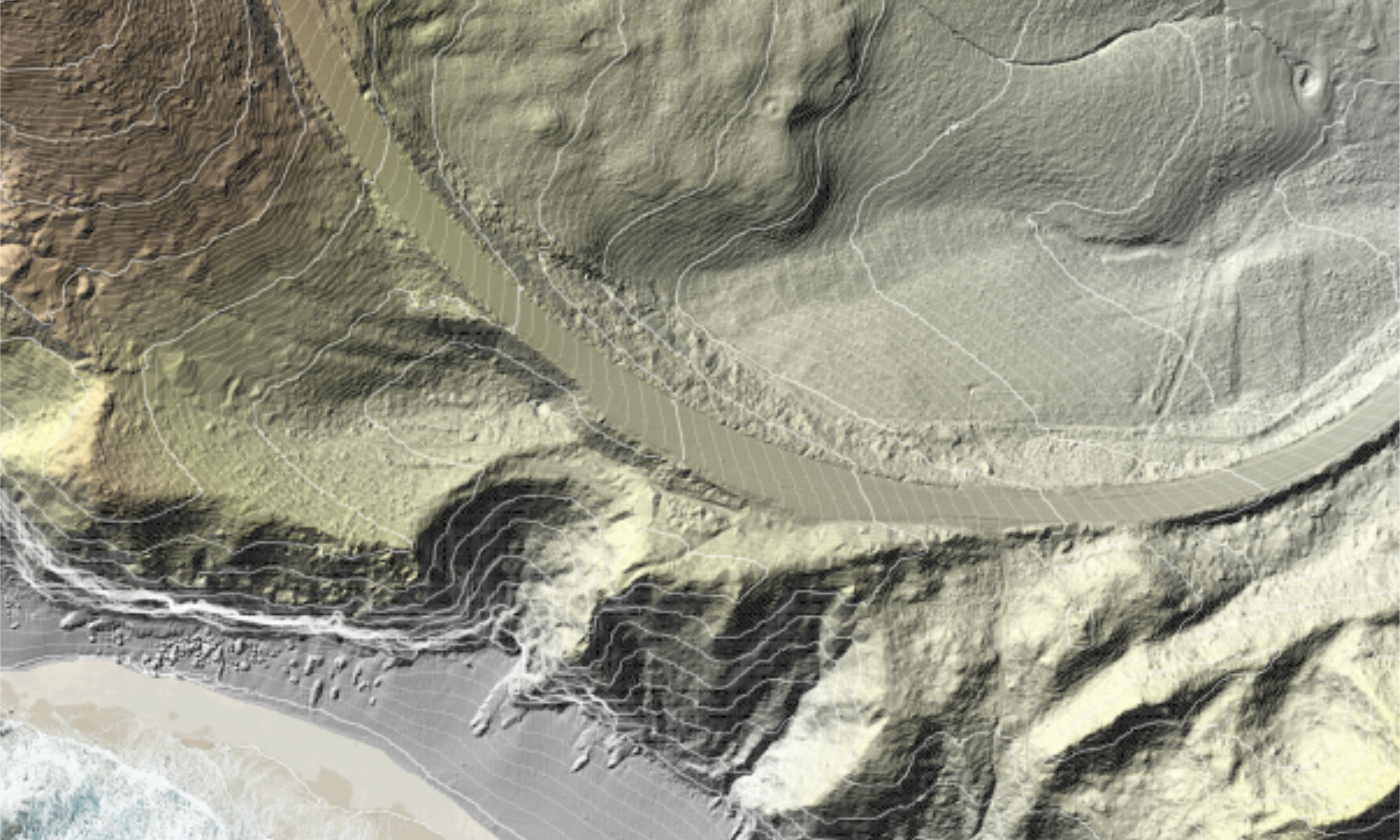
2019-20 Great Ocean Road LiDAR.
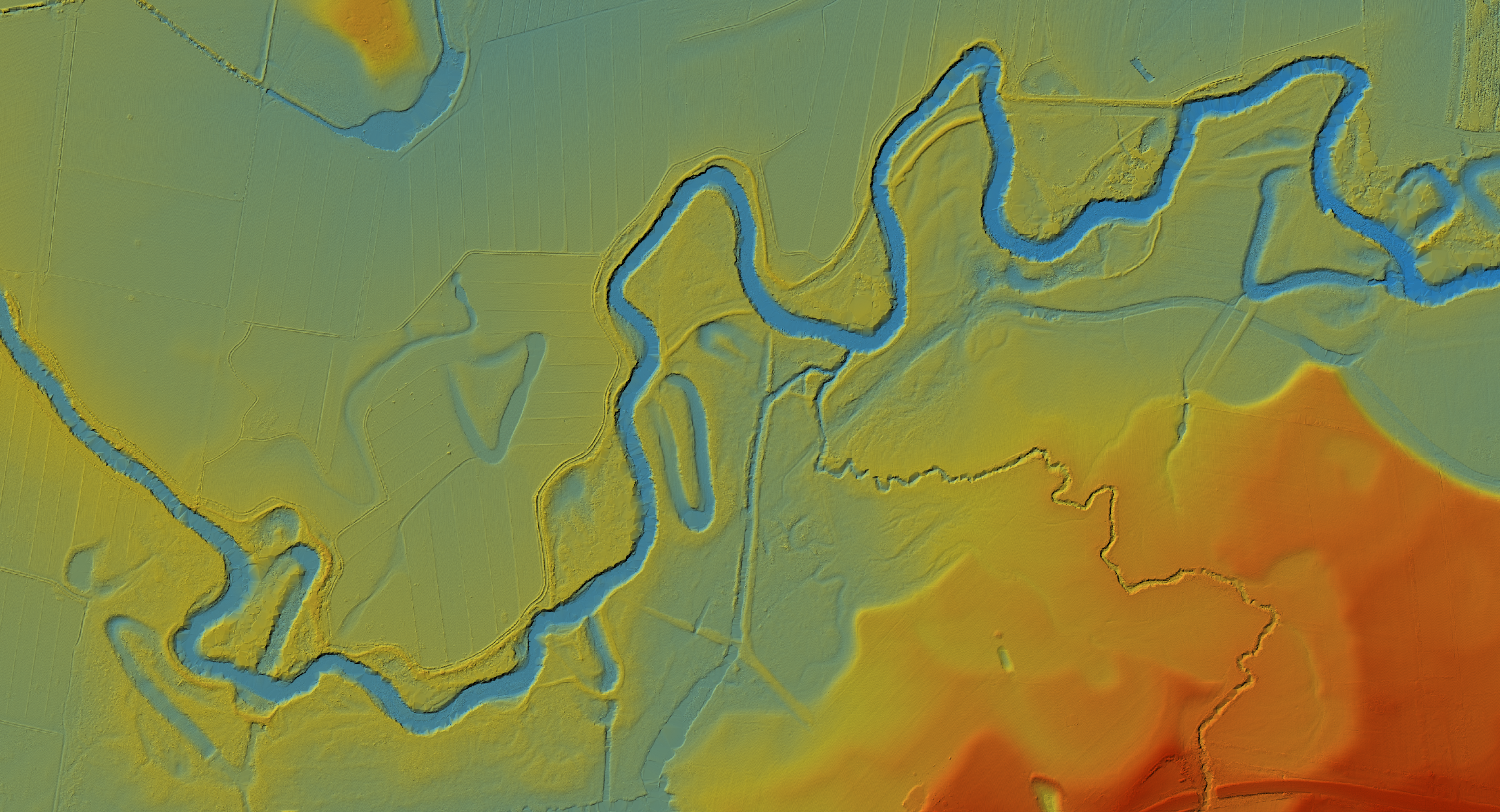
2009-10 Victorian rivers LiDAR.
Managing Victoria's elevation data
The Vicmap Imagery and Elevation team represents a centre of excellence within the Victorian Government for the acquisition, quality assurance, and management of the state's elevation data.
Through the Coordinated Imagery Program (CIP), large elevation projects are initiated and partnerships across government are leveraged to ensure data is cost-effective and will meet user needs across all levels of government. Once projects commence, the team procures from the whole-of-Victorian-government Geospatial Data and Analytics Panel of providers, ensuring that the government is accessing reliable and high-quality elevation suppliers.
Data is put through rigorous, best-practice quality assurance procedures before being placed into CIP’s data archive, from where other government partners and commercial resellers can access and license data for further use. Cost-recovery through such licensing supports the management and expansion of the archive and enables data access. Datasets in the archive also become part of the Vicmap suite and are used to create and maintain many other spatial datasets.
This elevation data work is supported by the Surveyor-General Victoria, whose data is critical for achieving a high level of vertical accuracy in the LiDAR data and ground surface Digital Elevation Models. These models establish the accuracy foundations for Vicmap 3D data.
Through this management, the team ensures that the Victorian Government’s elevation data archive is sustainable, high-quality, and supports maximum re-use for projects across the state.
How to access elevation data
To access existing elevation data or arrange a LiDAR survey, please get in touch with the Coordinated Imagery Program.
Page last updated: 24/04/26