
On this page:
What we do
We provide public sector access to Victoria’s extensive archive of aerial imagery data.
The archive includes historic aerial photographs from the 1930s to 1990s. It also includes recent digital high-resolution imagery, collected from across the state.
This data supports planning, emergency response, environmental research and government programs across Victoria.
The below images show aerial imagery of Wyndham overlaid with Vicmap Property boundaries. You can see considerable change in the community between 2015 and 2019 as new suburban housing developments were built.
Local councils and the Victorian Government use aerial imagery for planning, engineering, law enforcement and emergency management.
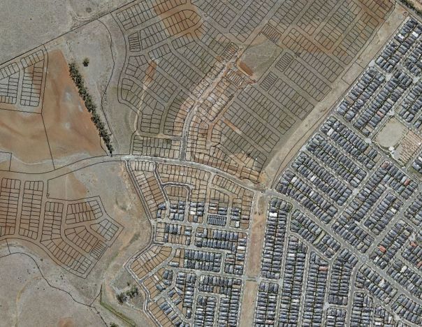
- Above: Aerial imagery of Wyndham development 2015 with Vicmap Property overlaid.
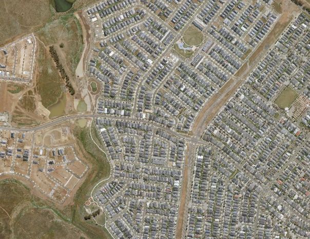
- Above: Aerial imagery of Wyndham taken in 2019.

Above: Aerial imagery of Wyndham development 2015 with Vicmap Property overlaid.

Above: Aerial imagery of Wyndham taken in 2019.
How to access high-quality, high-resolution imagery
Public sector organisations can join the Coordinated Imagery Program. We partner across the public sector to manage the acquisition and quality assurance of aerial imagery and geospatial data,ensuring that it is fit-for-purpose.
Members of the public and the private sector can purchase Vicmap Imagery from our spatial data retailers.
For more information, visit how to access spatial data.
For more information contact us.
Page last updated: 30/06/25