
On this page:

Overview
Vicmap Buildings is a collection of the best available building models across Victoria, providing a seamless 2D and 3D digital representation of the state’s built environment.
The collection includes data that is state-owned, as well as data licensed from commercial providers, to achieve state-wide building model coverage at varying levels of detail.
Vicmap Buildings is created using Vicmap Imagery and Vicmap Elevation data. More technical detail is provided in the Product Description. This new product includes datasets with three different Levels Of Detail (LOD) which broadly define the amount of information contained in a building model:
- LOD0 – showing 2D building outlines (Image 1 below)
- LOD1 – showing building outlines and heights extruded (Image 2 below)
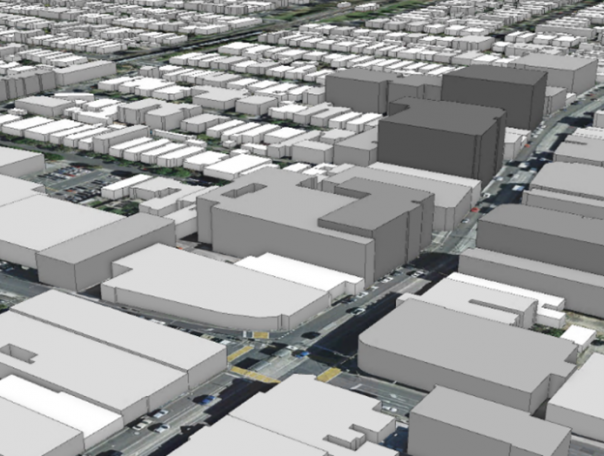
- LOD2 – showing building outlines with heights extruded and roof details (Image 3 below)

- LOD0 showing 2D building outlines.
- LOD1 showing building outlines with heights extruded.
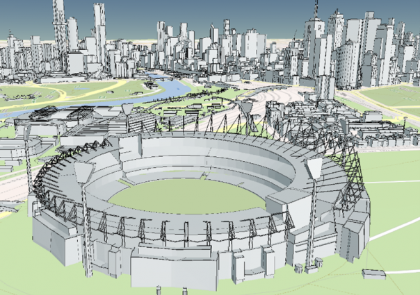
- LOD 2 showing building outlines with heights extruded and roof details of the Melbourne Cricket Ground.
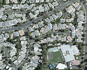
LOD0 showing 2D building outlines.
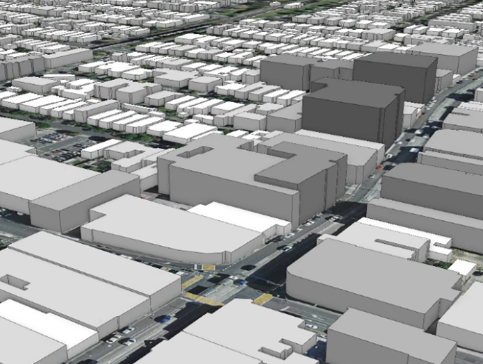
LOD1 showing building outlines with heights extruded.
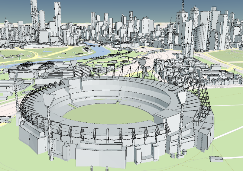
LOD 2 showing building outlines with heights extruded and roof details of the Melbourne Cricket Ground.
Vicmap Buildings provides high-level context of the built environment suitable for analysis to inform decision-making in a range of planning, environment, asset and risk management activities.
Vicmap Buildings is a foundational dataset for Victoria and aligns to the UN Global Fundamental Geospatial Data Themes of Building and settlements and Physical infrastructure (including utilities, telecommunications and water infrastructure). This theme is reflected in the ANZLIC Foundational Spatial Data Framework.
Explore the data
You can explore Vicmap data as a web mapping service in the Digital Twin Victoria (DTV) platform before enquiring about access:
Explore data in the Digital Twin Viewer
Access the data
Vicmap Buildings data can be viewed on the DTV platform, where it can be easily integrated with relevant information held across government, providing richer information and insights.
Contact coordinated.imagery@transport.vic.gov.au to access the data.
Technical detail
| Source information | Specification |
|---|---|
| Coverage | State-wide across Victoria at varying levels of detail. Please refer to product metadata statement below for more details. Please note: Vicmap Buildings currently has partial coverage over the City of Melbourne. Vicmap is working with authoritative data custodians to incorporate comprehensive building footprints over this area into Digital Twin Victoria. |
| Currency | Ranges from 2017 to 2022 |
| Scale of capture | 1:1,000 |
| Spatial accuracy | LOD2+ Building Models: absolute horizontal and vertical accuracy varies between +/- 0.10m > +/- 0.50m RMS LOD1 Building Outlines: Vicmap Buildings main specification covering Greater Melbourne and Geelong contains 2D features have been extracted from 10cm imagery with 30cm horizontal accuracy for features on the ground. Building outlines are a depiction of the roof edges as they appear in the source imagery resulting in a maximum horizontal radial displacement (building lean) ratio of 2.5-1. LOD1 Building Outlines: multi-representation of higher LOD Models Rural block buildings: information on accuracy can be found in the Geoscape Buildings Product Guide v3.1 |
As we continue to improve Vicmap Buildings, new attributes will be added through future releases.
Product resources
Get in touch with us
To access the product or for help or further information, contact coordinated.imagery@transport.vic.gov.au.
Page last updated: 19/11/25