
On this page:
Overview
The Department of Transport and Planning (DTP) manages the operation, maintenance and enhancement of an integrated, state-wide network of Global Navigation Satellite System (GNSS) ground stations.
These stations collect positioning data from systems such as the Global Positioning System (GPS) and distribute real-time data streams to enable precise positioning services.
The network is known as GPSnet and consists of more than 120 GNSS ground stations that support centimetre-level positioning services 24 hours a day, 365 days per year. All national coordinate systems are supported by the network.
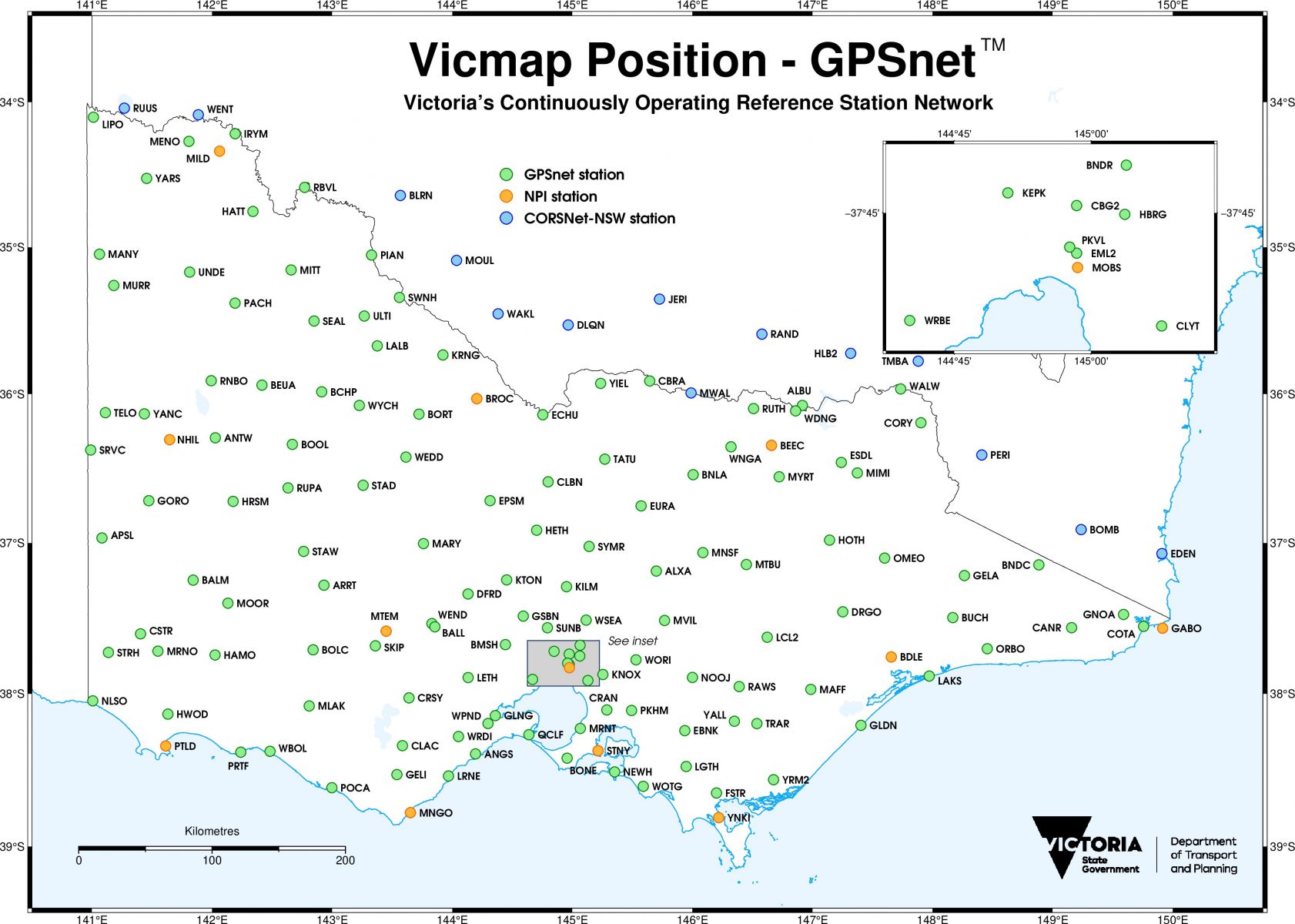
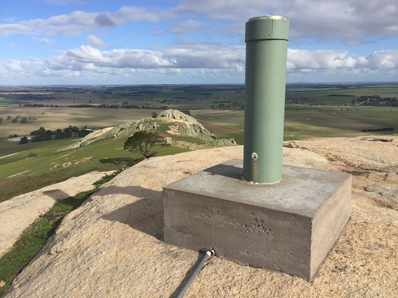
The GPSnet ground stations feature an antenna that tracks satellite signals from all available GNSS satellite constellations. The data is captured in a receiver and distributed through reliable communication systems. More information on GPSnet is available from the Vicmap Position - GPSnet webpage.
The positioning infrastructure and information services enables precise positions to be seamlessly integrated into mapping applications. This helps to increase productivity for businesses and the Victorian community.
There are a wide range of industries that benefit from precise positioning services, such as:
- agriculture
- construction
- transport
- surveying and spatial
- science
- asset and resource management.
An overview of precise positioning technologies and their transport applications can be found in our report:
The Positioning Australia program
Through a collaborative arrangement, the department is actively contributing to the Positioning Australia program led by Geoscience Australia.
This program delivers precise national positioning. It is designed to both accelerate adoption and facilitate innovation in positioning technologies.
The program includes:
- support for precise positioning to within 3 cm anywhere in Australia with internet coverage
- instant access to accurate positioning to within 10 cm across both Australia and New Zealand by 2023
- free access to both single base real-time and RINEX GNSS data across the entire country.
For more information, refer to the SouthPAN factsheet:
Commercial positioning services
Commercial precise positioning services include subscription-based access to both real-time Network RTK and RINEX GNSS data.
Services include:
For archive GNSS RINEX Data please visit the GNSS Data Repository.
For Real-time GNSS Data visit Geoscience Australia.
Page last updated: 31/10/24