

- Mapping Deen Maar
- Mapping Deen Maar

- Mapping Deen Maar

- Mapping Deen Maar
Mapping Deen Maar

Mapping Deen Maar
Mapping Deen Maar
Mapping Deen Maar
7 July 2021
The Department of Environment, Land, Water and Planning (DELWP) has improved the mapping of Victorian Aboriginal cultural heritage site Deen Maar.
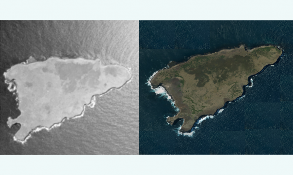
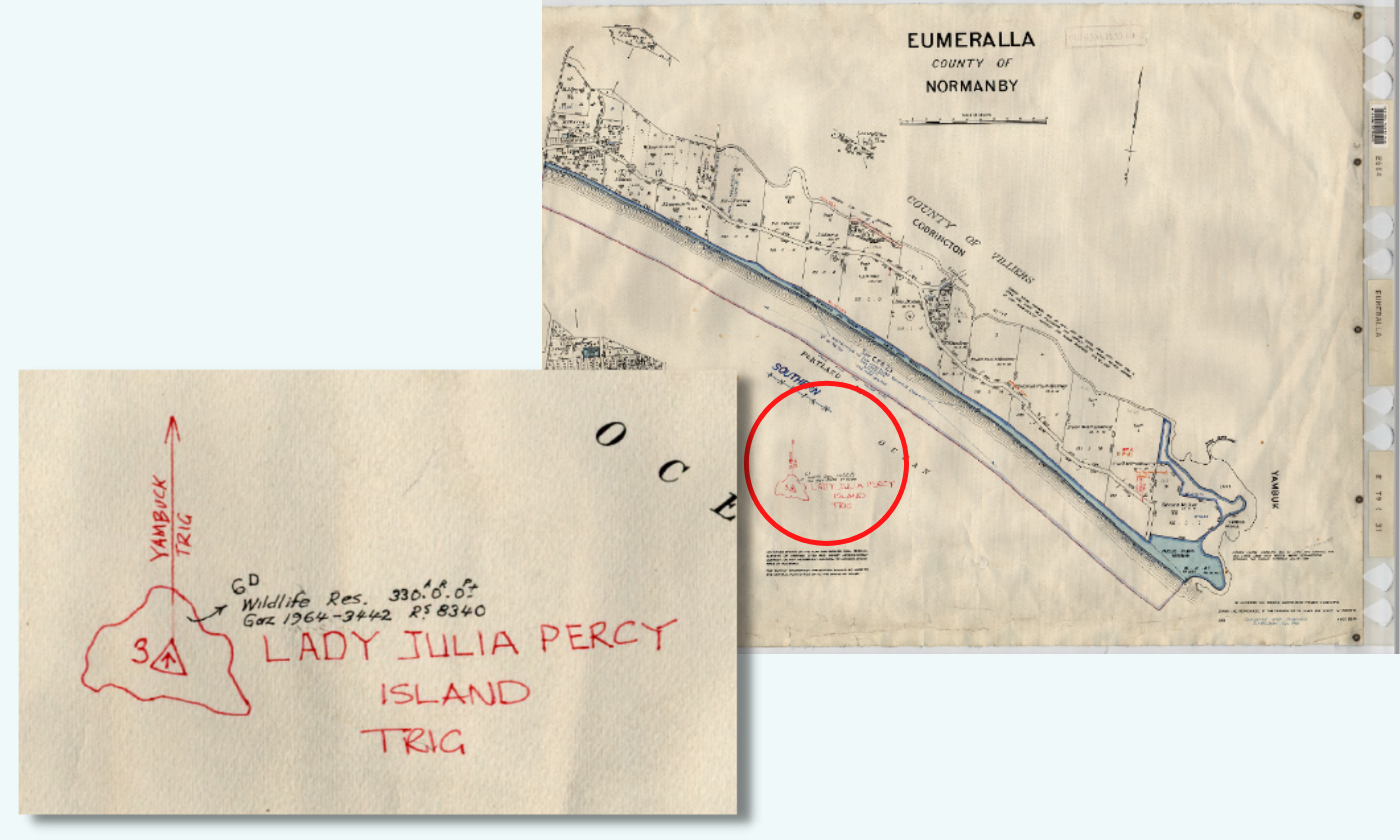
Officially named Lady Julia Percy Island by Lt James Grant in 1801, this small island 22km south-west of Port Fairy is known to Eastern Maar and Gunditjmara people as Deen Maar, a site of spiritual significance for Aboriginal Victorians for its role in Bunjil creation stories.
The rocky island, which formed approximately 8 million years ago from an undersea volcanic eruption, is Australia’s only offshore volcano and is inhabited by the largest fur seal colony in the southern hemisphere.
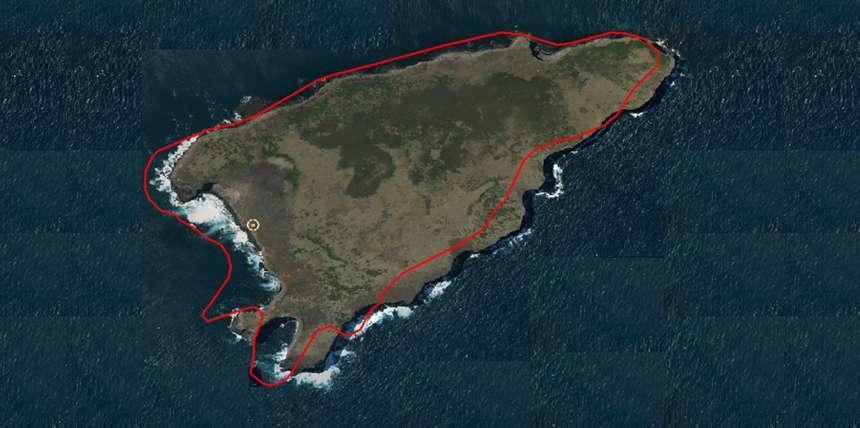
As part of the DELWP Digital Cadastre Modernisation Program to digitise 3.3 million property parcels in Victoria, the Crown Land Survey team in Surveyor General-Victoria obtained aerial photos of Deen Maar in February 2021 at a resolution of 10cm. The data for the project was sourced by Coordinated Imagery Program working with partner Landair Surveys.
This is a significant improvement from the last survey of Deen Maar in 2003 when DELWP acquired Landsat satellite imagery with a resolution of 50cm.
From this valuable mapping data, the Digital Cadastre Modernisation team will be able to correct the existing discrepancy in the current parcel boundary and represent Deen Maar accurately in Vicmap mapping products: Vicmap Admin, Vicmap Crown Land Tenure, Vicmap Index and Vicmap Planning.
This survey data will also help Parks Victoria manage wildlife on Deen Maar and enable Geoscience Australia to obtain an accurate Victorian sea territorial baseline, and better model and manage erosion, sedimentation and climate-change induced sea-level rises along Victoria’s coast.
DELWP will work with Traditional Owners to integrate the Deen Maarimagery into future versions of the Vicmap Basemaps. We will also transfer ownership of culturally significant data or data that is of importance to Traditional Owners in line with Outcome 2.2 ‘Recognise and enable Indigenous Data Sovereignty’ under Pupangarli Marnmarnepu, the DELWP Aboriginal Self-Determination Reform Strategy 2020-2025.
The data can improve the mapping of Native Title for Deen Maar by the Eastern Maar Traditional Owners and the Gunditj Mirring Traditional Owners Aboriginal Corporation, and can be used in their activities to care for country and celebrate their connection to this part of Victoria and the significant cultural heritage associated with the island.
A shared story from Gunditjmara Traditional Custodians about Deen Maar:
In language
Tarn Weerreeng peenpa keetnan meerteeyt moongay, ngakapa deen maar.
Weerreeng tharn moongay, pakarr meerreeng ba deen maar.
Kalpeerna-k-ya kalpoornity-nyoong pootoong-ee yoowoo-k moorraka-yee.
Ngoolang-I tarn weerreeng tyama-ngeen Pooyeet Pooyeet Tyeepeety-ei wampan kalpeernitj-ngat kana-nyoong ba pangoneeyt-nyoong yunyin Tarn Weerreeng nhoompi Deen Maar nhoolampi wampan weerreeng kanoo moorna-nyoong-ee/yakeenitj-ee.
Ngaken-u-ya ngeeram teena tyama-ngeen weeyn-yee wampan kanoo.
Ngaken-u-ya teena tarn Weerreeng-i-ngooty pootoong waloong teekoornayko moorrakan maara parta-n pangyana-wan waloong moongay kalo pootoong kalpeerna wampan poorray
English translation
On the coast across from Deen Maar there is a haunted cave called Tarn Weerreeng which has a path between the land and Deen Maar. When someone dies the body is wrapped in grass and put in the burial place.
When the grass is found at the mouth of Tarn Weerreeng you know that Pooyeet Pooyeet Tyeepeety took the body and its belongings through Tarn Weerreeng to Deen Maar and carried the person’s spirit to the clouds.
If maar see a meteor at the same time it is believed that fire has been taken up with it.
If there is fresh grass found near Tarn Weerreeng someone was killed and no one will go near until the grass decays or is removed.
Source: Culture Victoria
Page last updated: 07/07/21