
On this page:
Overview
Victoria StateView is a collection of high-resolution 1.5m satellite imagery across Victoria derived from the Earth observation satellite constellation of AIRBUS SPOT6/7.
The high level of accuracy and detail provided by satellite imagery allows for precise mapping and monitoring of large areas, making it easier to identify changes over time. This can be particularly useful in areas such as disaster response, environmental monitoring, agriculture, forestry, urban planning and infrastructure development.
What is available
This collection will contain three state-wide satellite imagery mosaics:
- 2021-2022 imagery
- 2022-2023 imagery
- 2023-2024 imagery
The satellite images that form the mosaics also form part of the collection as a separate product.
The satellite mosaics are available in both natural colour and false colour, providing users with a comprehensive view of the state over time. The mosaics are colour-balanced to be seamless and orthorectified to a high spatial accuracy.
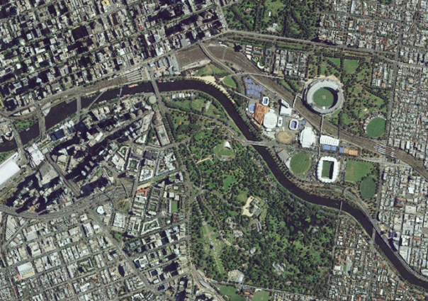
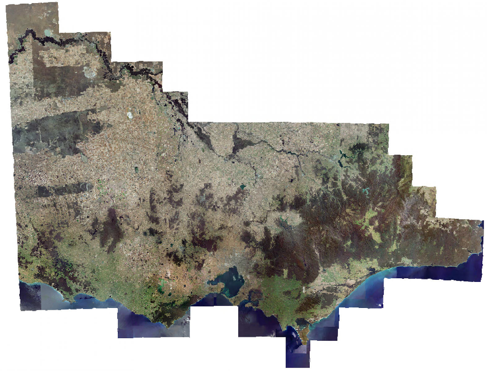
- Source: Victoria captured by SPOT6/7 © Airbus DS (2022-2023), available in natural colour.
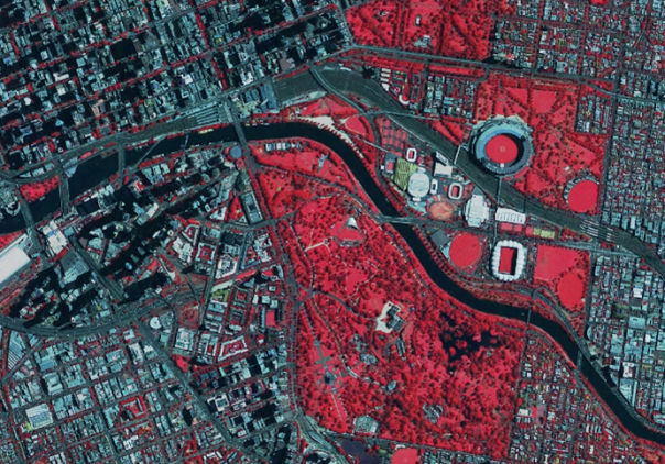
- Source: Victoria captured by SPOT6/7 © Airbus DS (2022-2023), available in false colour.
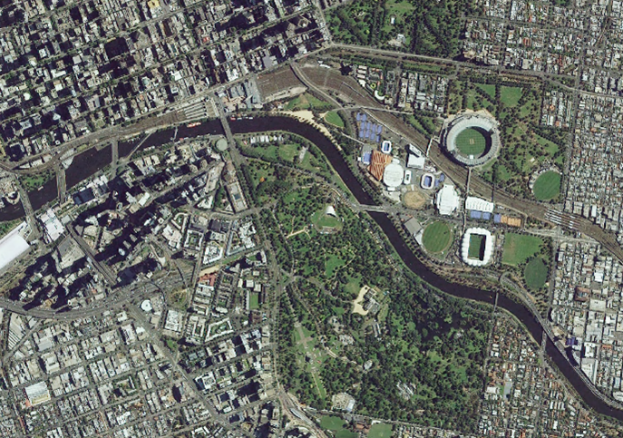
Source: Victoria captured by SPOT6/7 © Airbus DS (2022-2023), available in natural colour.
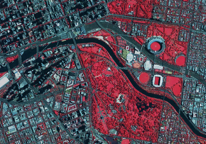
Source: Victoria captured by SPOT6/7 © Airbus DS (2022-2023), available in false colour.
Who can use Victoria StateView?
Victoria StateView is only available to Victorian state and local government agencies via the Coordinated Imagery Program.
Explore data
The collection is published through a web map service (WMS) via Image Web Server and the Digital Twin Victoria platform to be viewed as a complete mosaic.
You can view Victoria StateView collection in:
- Digital Twin Victoria platform as basemap option
- IWS Viewer (maps.vic.gov.au) (restricted access – open to Victorian Government only, including Local Government)
- Web Map Service (WMS) (restricted access – open to Victorian Government only, including Local Government), search for image name: Victoria_<capture years>_sat_<band combination>_150cm_epsg7899.
You can also explore Victoria StateView 1.5m dataset spatial footprints with metadata in StateView 1.5m Source Map (mapshare.vic.gov.au).
Contact coordinated.imagery@transport.vic.gov.au to access:
- Orthorectified swaths (raw data).
- Mosaic tiles (mosaicked and colour balanced) which include the original full-colour fidelity 16-bit mosaic tiles (for analytics) and the publish-ready 8-bit mosaic tiles (for visual).
Technical detail
| Source information | Specification |
|---|---|
| Coverage | Statewide |
| Currency | Epoch 1: 2021/2022 Epoch 2: 2022/2023 Epoch 3: 2023/2024 |
| Datum |
|
| Data format |
|
| Spatial accuracy | CE90 of 5m |
How to get help
For more information, please contact coordinated.imagery@transport.vic.gov.au.
Page last updated: 16/06/25