
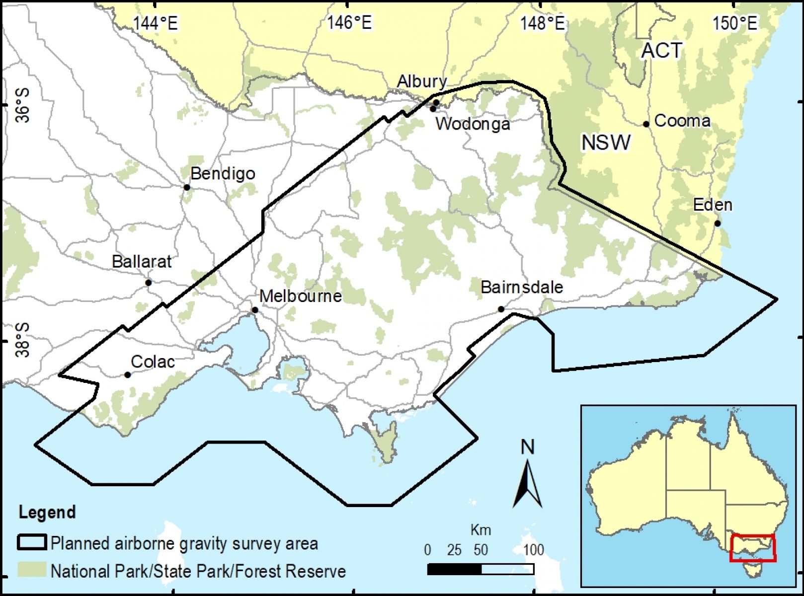
Surveyor-General Victoria, in collaboration with Geological Survey of Victoria and Geoscience Australia, will perform airborne gravity surveys across southeast Victoria throughout 2021. The surveys will cover approximately 100,000 square kilometres, including the Victorian coast from Cape Otway to Cape Howe, metropolitan Melbourne and the Australian Alps.
8 December 2020
The new airborne gravity surveys will provide consistent and evenly distributed gravity measurements across diverse land types including urban and rural areas, mountainous and coastal terrain and parks/reserves.
The gravity data is required to improve the geoid model that will be the basis of the Australian Vertical Working Surface (AVWS). The AVWS is a significant part of the Australian datum modernisation program and is being introduced as an alternative to the almost 50-year old Australian Height Datum (AHD). The airborne gravity surveys are designed to ensure the new AVWS over Victoria is the best it can be.
AVWS can be instantly and easily accessed using GNSS through application of a geoid model. The airborne gravity data will improve the accuracy of real-world heights from GNSS positioning, instantly and seamlessly, anywhere in Victoria.
Gravity data is usually collected for geological mapping. Geological Survey of Victoria are interested in the gravity data to better understand south-east Australia’s geological ‘architecture’ and how it has evolved over time. This helps manage earth resources, infrastructure and natural hazards.
Following data capture, processing and quality control analysis the gravity data will be incorporated into existing state and national public geoscience databases. It will then be made publicly available by Geoscience Australia and Geological Survey of Victoria.
Key information for locals
- The airborne gravity surveys will have minimal disturbance to land users and the environment. They will be performed by an experienced specialist contractor and involve a small fixed wing aircraft flying along flight lines spaced about 1-2km apart.
- The aircraft will fly in public airspace at a nominated ground clearance of 150 metres, increasing to 300 metres over built-up areas.
- The gravity sensing instruments are passive and do not emit any signals or impact people, animals or infrastructure in any way.
- Stakeholders will be notified at least two weeks prior to commencing operations across regions.
Page last updated: 11/07/23