
23 May 2023
A large airborne gravity survey is underway across southern and eastern Victoria to improve the accuracy of heights from GPS positioning. This improvement will enable positioning to a few centimetres anywhere in Australia.
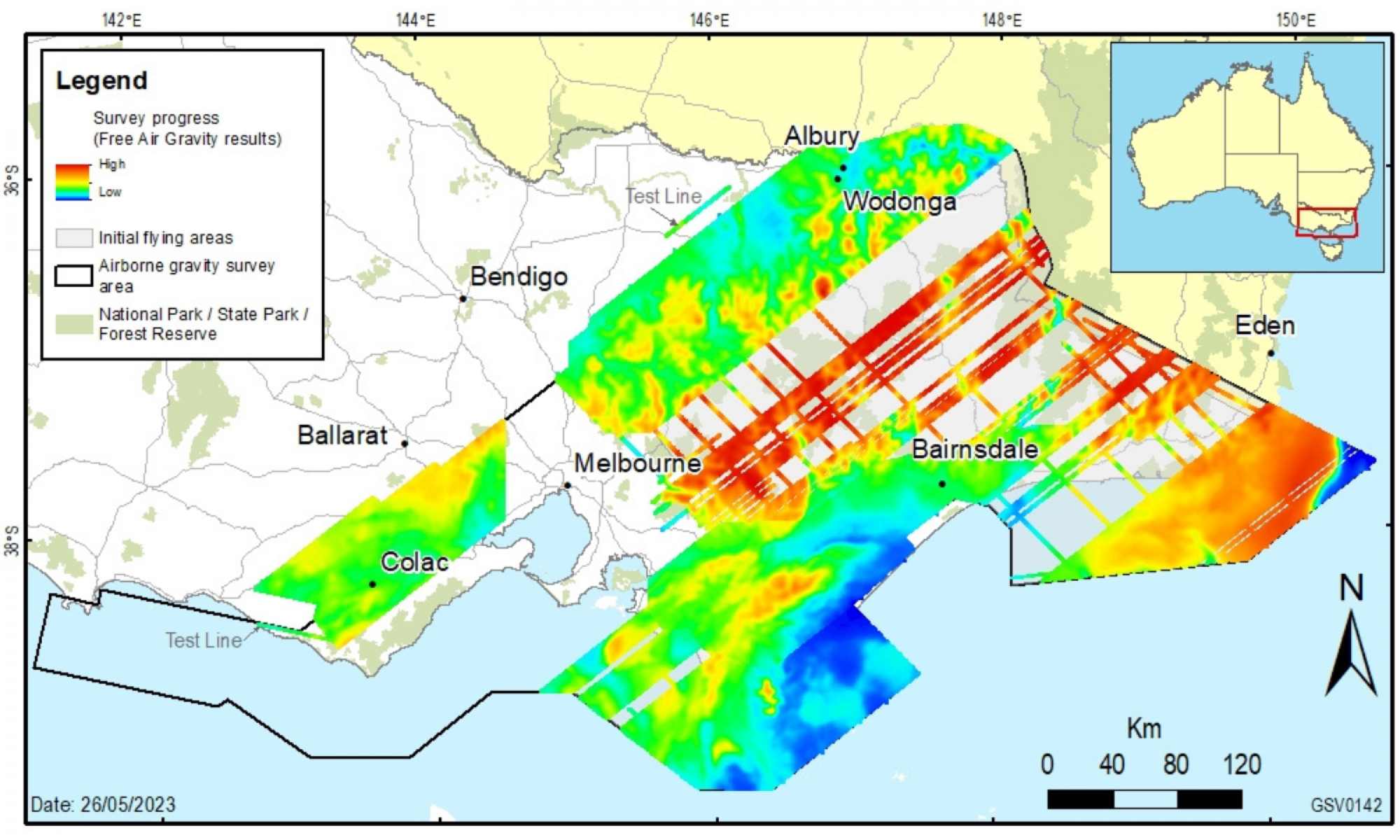
Having already completed 42% of the survey area, the airborne gravity survey is continuing operations over the Gippsland and Hume regions. The accompanying image of the survey project area shows progress to date and the next areas of operation.
Experienced pilots are flying a DHC-6 Twin Otter fixed-wing aircraft along a planned route, with flight lines spaced 500 metres to 1 km apart. The aircraft will fly in public airspace with a minimum 150 metres ground clearance, increasing to 300 metres over built-up areas.
The specialised gravity sensing equipment does not emit any signals and people, animals and infrastructure are not impacted in any way.
The new gravity data will significantly improve Victoria’s gravity model. Measurements will be collected consistently and evenly and used to provide accurate and reliable heights from GPS positioning.
The gravity data and model products will be made freely available through Geoscience Australia and the Victorian government’s online data portals. It’s all part of our plan to improve GPS positioning across Victoria.
Stakeholders are being notified at least two weeks prior to commencing operations across regions, with the airborne gravity survey being performed in stages throughout 2023 and 2024.
This project is being collaboratively organised by Surveyor-General Victoria (SGV), Geological Survey of Victoria and Geoscience Australia.
Read more about the project and the work of the SGV:
Page last updated: 28/08/23