
27 September 2022
GPS positioning accuracy is being improved to enable positioning to a few centimetres anywhere in Australia. To support this work, a large airborne gravity survey is being flown across southern and eastern Victoria to improve the accuracy of heights from GPS positioning.
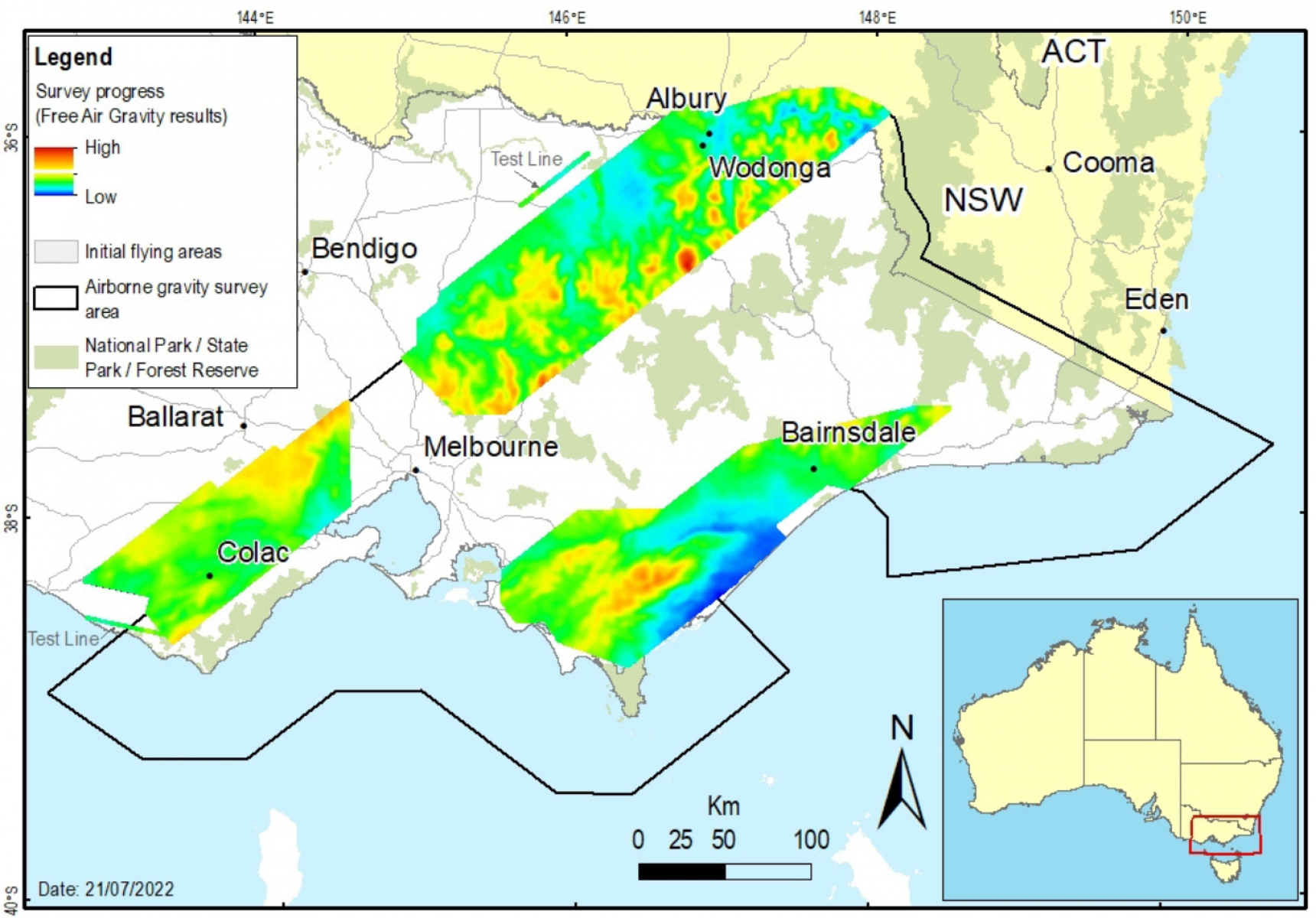
To date, 24% of the survey area over land in the Gippsland, Otway and Hume regions has been completed. Operations are scheduled to recommence over the Otway and Greater Melbourne regions in November.
Experienced pilots, operating a DHC-6 Twin Otter fixed-wing aircraft, will fly along a planned route with flight lines spaced 500 metres to 1 km apart. The aircraft will fly in public airspace at a nominated minimum ground clearance of 150 metres, increasing to 300 metres over built-up areas.
The specialised gravity sensing equipment does not emit any signals or impact people, animals or infrastructure in any way.
This project will collect consistent and evenly distributed gravity measurements. The new gravity data will significantly improve Victoria’s gravity model which is used to provide accurate and reliable heights for GPS positioning.
The gravity data and model products will be made freely available through Geoscience Australia and the Victorian government’s online data portals. It’s all part of our plan to improve GPS positioning across Victoria.
The airborne gravity survey is being performed in stages through 2022 and 2023 and stakeholders are being notified a minimum of two weeks before operations start in each region.
This project is being organised by Surveyor-General Victoria (SGV), Geological Survey of Victoria and Geoscience Australia.
Read more about airborne gravity surveys and the work of the SGV:
Page last updated: 11/07/23